
Lochaber Geopark – Rock Routes


Scenic Drives & Days Out
Activity Details
Travel through time and landscapes with more than 20 Lochaber Geopark interpretation boards across Lochaber
Some great drives out over a couple of days where you can follow the Lochaber Geopark ‘Rock Routes’ to visit all the boards. These routes link 20 outstanding viewpoints where Lochaber Geopark has installed boards that explain how the magnificent scenery reflects the dramatic geological history of the surrounding area. The geology is described on a colourful interpretation panel installed, in most cases, on a beautifully hand-crafted stone plinth – using local stone, of course!
The boards also describe the origins of specific geological features which can be easily seen from each location.
They have been written in such a way as to provide stand-alone information, although to get a more complete picture of the area’s amazing geological history you will really need to visit more than one.
Rock Route Leaflet
You do not have to visit the boards in any particular order, but we have arranged them in groups, so that you can travel from one to the other in a sensible manner as you drive out of Glencoe in a particular direction.
The map below shows 20 of the board locations and the suggested routes, as well as some information on additional places of geological interest.
Rock Route Journeys
Two types of ‘Rock Route’ have been developed.
- Thematic Routes: groups Boards across Lochaber around common geological themes.
- Regional Routes: give a flavour of the variety of geology which can be found in smaller geographic areas.

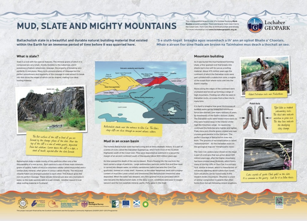
12. MUD, SLATE AND MIGHTY MOUNTAINS
Learn about the long history of this beautiful and durable natural building material. These slates were used on thousands of Scottish homes
Ballachulish slate quarry.
PH49 4JB
Grid ref: NN083584

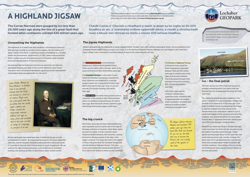
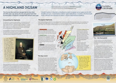
15. A HIGHLAND JIGSAW
The Corran Narrows were gouged by ice less than 20,000 years ago along the line of a great fault formed when continents collided 430 million years ago.
Corran Ferry, E side.
PH33 6SE
Grid ref: NN022635

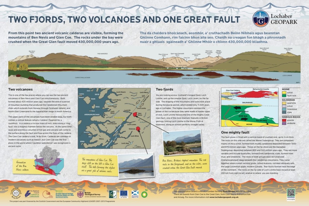
17. TWO FJORDS, TWO VOLCANOES AND ONE GREAT GLEN
The Ben Nevis and Glen Coe calderas are both visible. Red rocks nearby were crushed when the Great Glen fault moved.
Sallachan Bay. Lay-by on A830 5 km SW of Corran Ferry.
PH33 7AB
Grid ref: NM 975623

18. A VOLCANIC CAULDRON
The Glencoe volcanic caldera and the mountains of Ballachulish form a splendid panorama.
Loch Leven. Lay-by on B863 4 km W of North Ballachulish.
PH33 6SA
Grid ref: NN088603

Where you'll Find Us
Find the perfect place to stay while here in Glencoe
Hotels Bed and Breakfast / Guest House Self Catering Caravan, Camping & Glamping